This year Romania peaked the top of my ever expanding bucket list of countries to explore. For some reason, Romania is not one of those places found on many hiker’s bucket lists, but I hope my blog can persuade you to at least consider it. I can promise you that the mountains are breathtaking and well worth a visit.
Who, What, Where…?
There did not appear to be an abundance of information in English on the internet for hiking in Romania; however, I did find a couple of useful links and from these I came across articles and stories pointing to various National Parks and from these I ended up getting drawn towards Retezat National Park in Western Romania.
Some of the top “selling” points for me in choosing this National Park:
– Due to the park being isolated it provides a truly wild experience
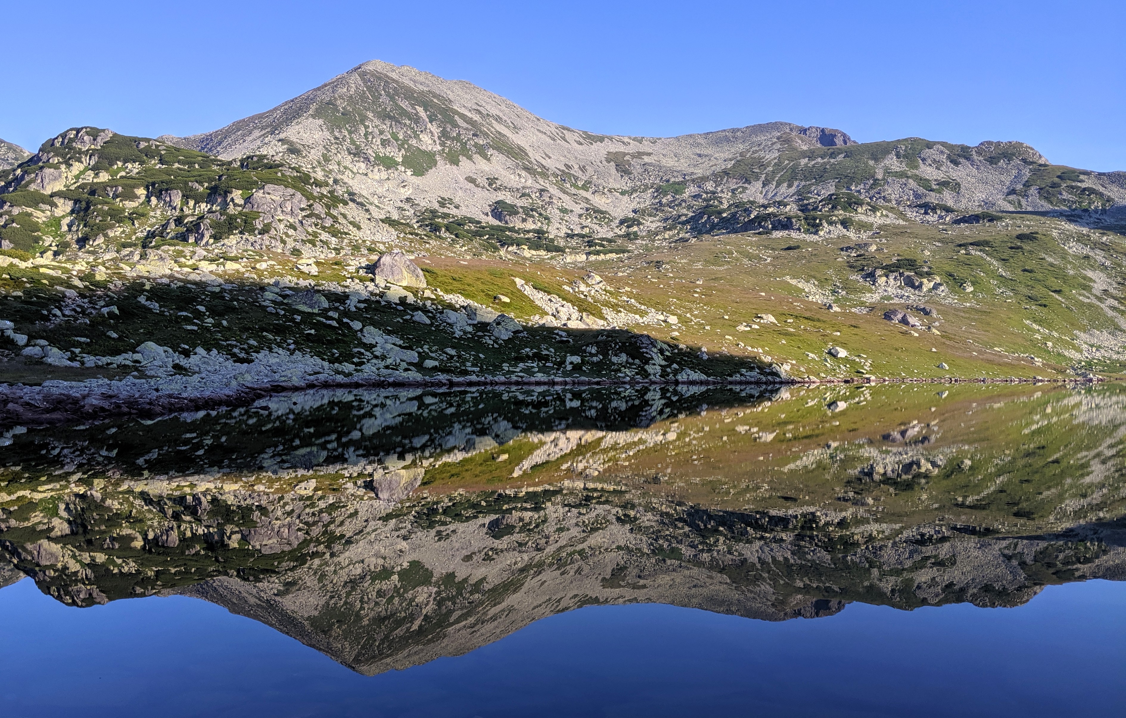
– 20 mountain peaks over 2000m
– 80 natural glacial lakes
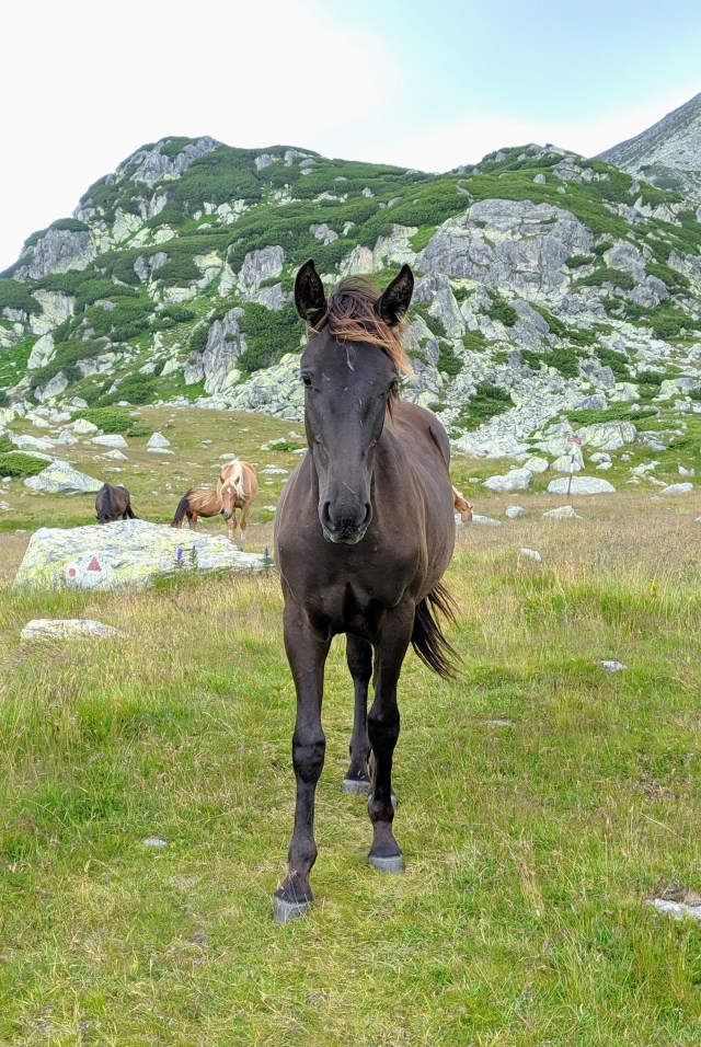
– An abundance of wild animals, including bears, wolves and Lynx.
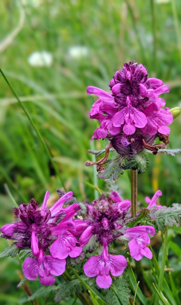
– Many rare and unique plants and flowers grow here
– It remains relatively unknown, particularly to those outside of Romania
– I like taking photos of beautiful places
– Summer weather conditions are relatively comfortable for camping
As soon as I had settled on this location in my mind, I ordered a map and started planning my next adventure in more detail. (A note on Romanian maps…those contour lines don’t do the reality of the mountain’s incline justice!) I bought a map online but you can buy a map from Nucsoura Information Centre on your arrival at the Park. This website also provides a good overview of the routes https://www.welcometoromania.ro/Retezat/Retezat_Harta_r.htm
My friend Cat, who I hiked with in Northern Sweden last year, had already hinted her interest in joining me on this trip so it was only a matter of telling her what dates she needed to book her flights for. It also transpired that my Mother and Aunt were also keen for an adventure, so they soon found themselves ordering new kit and booking flights to join us on our thrill seeking trip.
Getting to Retezat National Park
We settled on flying into Cluj Napoca and flying back to the UK (London Luton) from Sibiu. We hired a car to assist with getting to and from the Park. There is a car park that you can use for free at the start of the trail from Carnic (past the Cabanas).
The drive from Cluj Napoca airport to Carnic (including a tea break) took 6 hours.
From Carnic to Sibiu the car journey took around 2 hours
There are also bus, train and taxi options but we decided against these due to travel time (bus/train) and cost (taxi). Believe Hateg is the nearest main train and bus station if this is a better option for you.
Where to sleep?
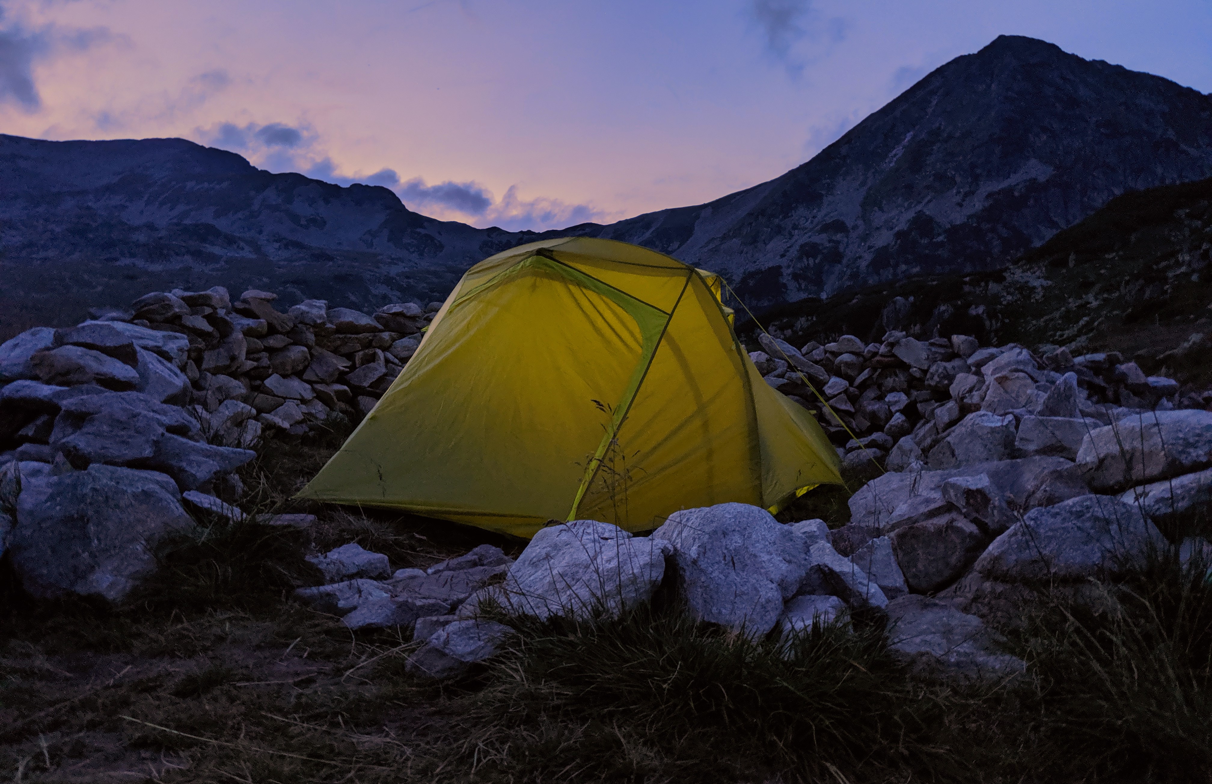
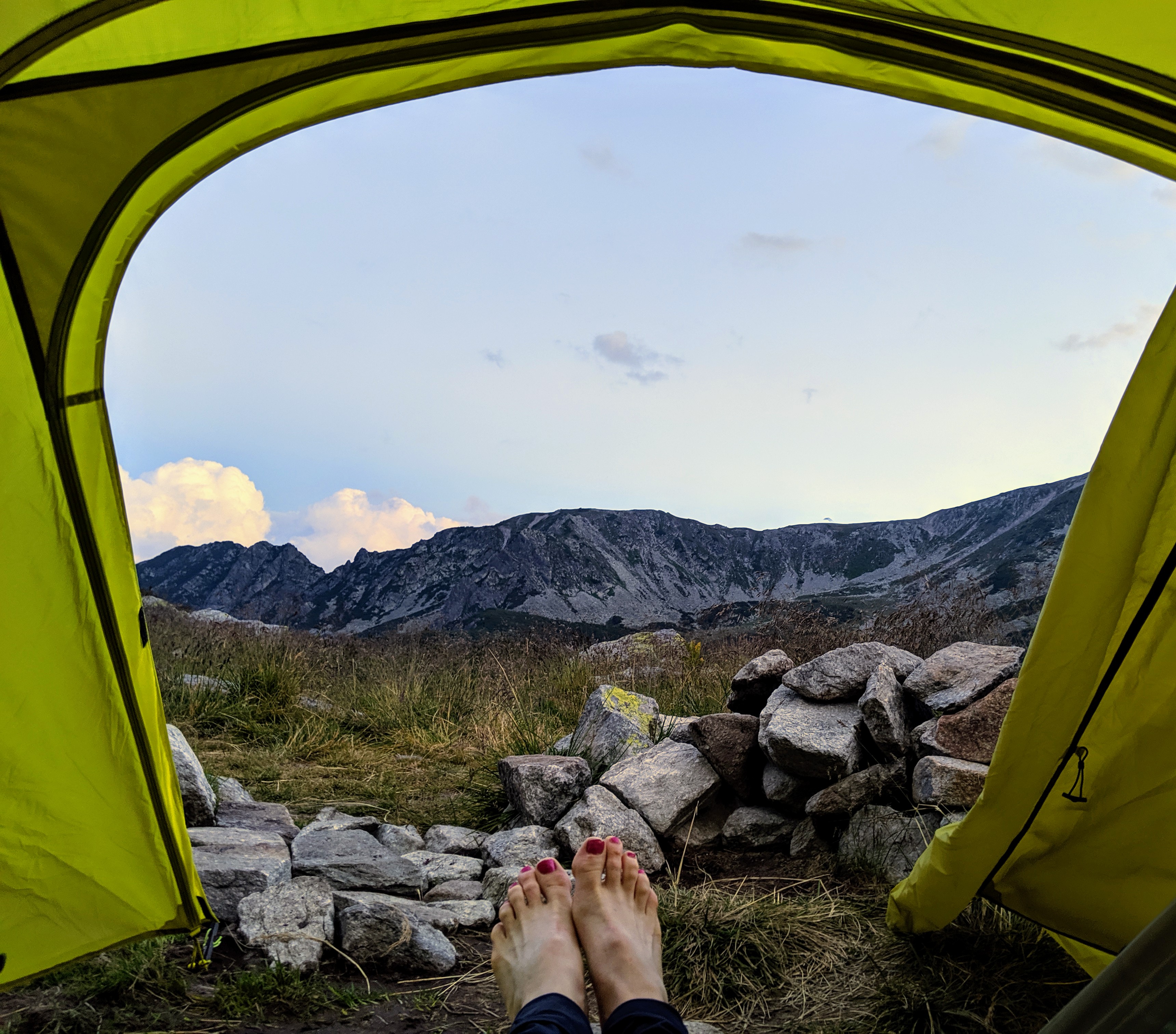
I love the feeling of opening my “front door” to fresh air and an amazing view, so grabbing the tent for this trip was a no-brainer.
In the National Park you are restricted to camping in designated camp areas, which are clearly marked on the available maps. There are also a limited number of Cabanas dotted around if you prefer a firmer front door.
We stayed at a campsite in Carnic (50leu / person) on the night we arrived in Romania and then used the designated camp sites located at Lake Bucura and Buta (both free to stay at) during our stay in the Park.
Lake Bucura is a central camp site that most hikers exploring the National Park appear to gravitate towards as it is the starting point for a few great day hikes, plus it’s simply very beautiful.
One major downside to staying at Lake Bucura camp site is the lack of toilet facilities. Being such a central site, draws more people than average to this area. I was obviously not expecting proper toilets but the lack of a drop toilet (or similar) means that you have to seek a hiding spot behind rocks and you must tread very carefully…because you are not the first person to go behind that large rock!
TOP TIP – Purchase your cooking gas cylinders on the way to the Park if you are flying into the country. We had to buy our gas from Decathlon in Deva, which was a 1 hour 30 mins detour back the direction we had come from.
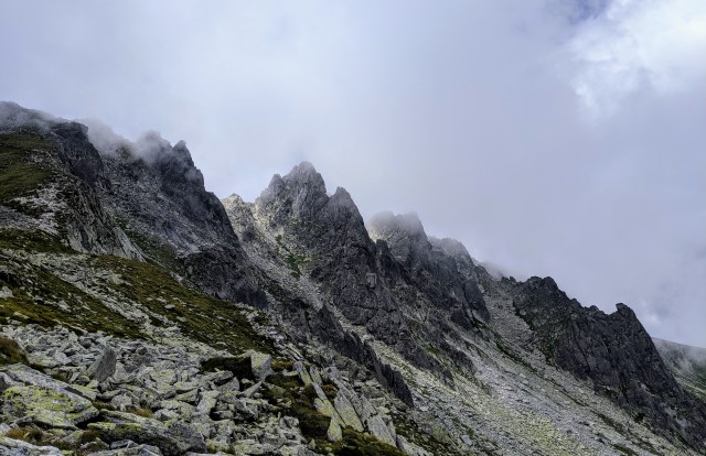
Beautiful Trails
The majority of the trails are well marked and clear to pass. It is worth checking with the mountain leader when you buy your national park pass about the routes you plan to hike. A couple that we had penciled in were too overgrown to pass.
Some thoughts on a few of the amazing routes that we did:
Carnic to Bucura
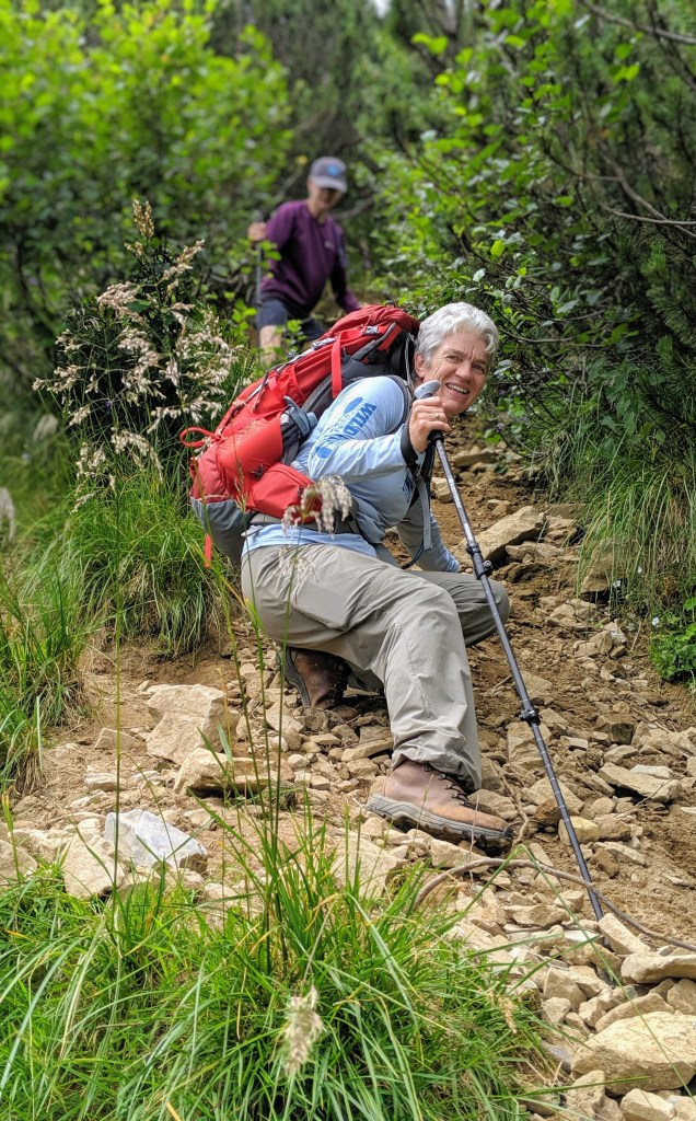
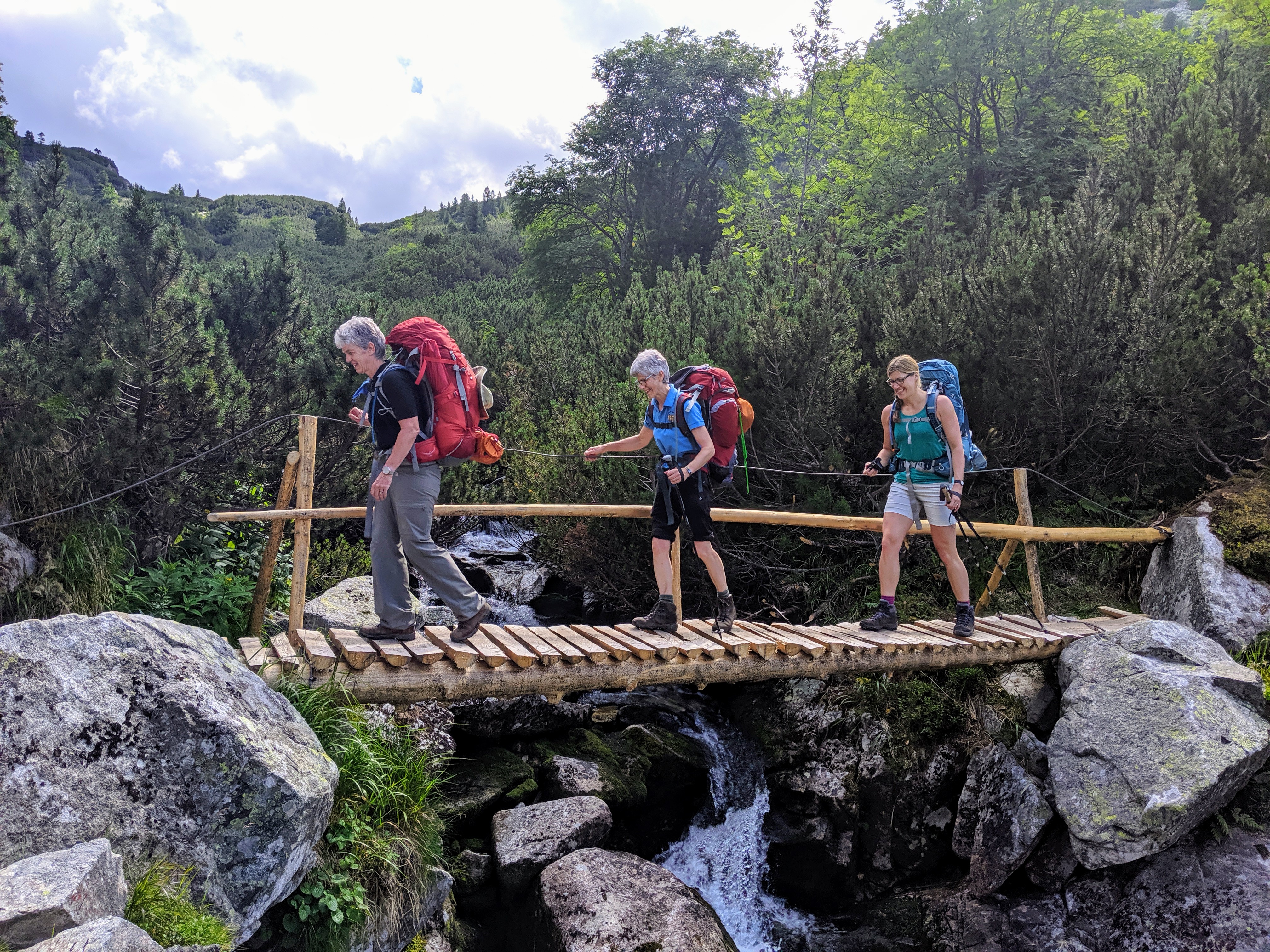
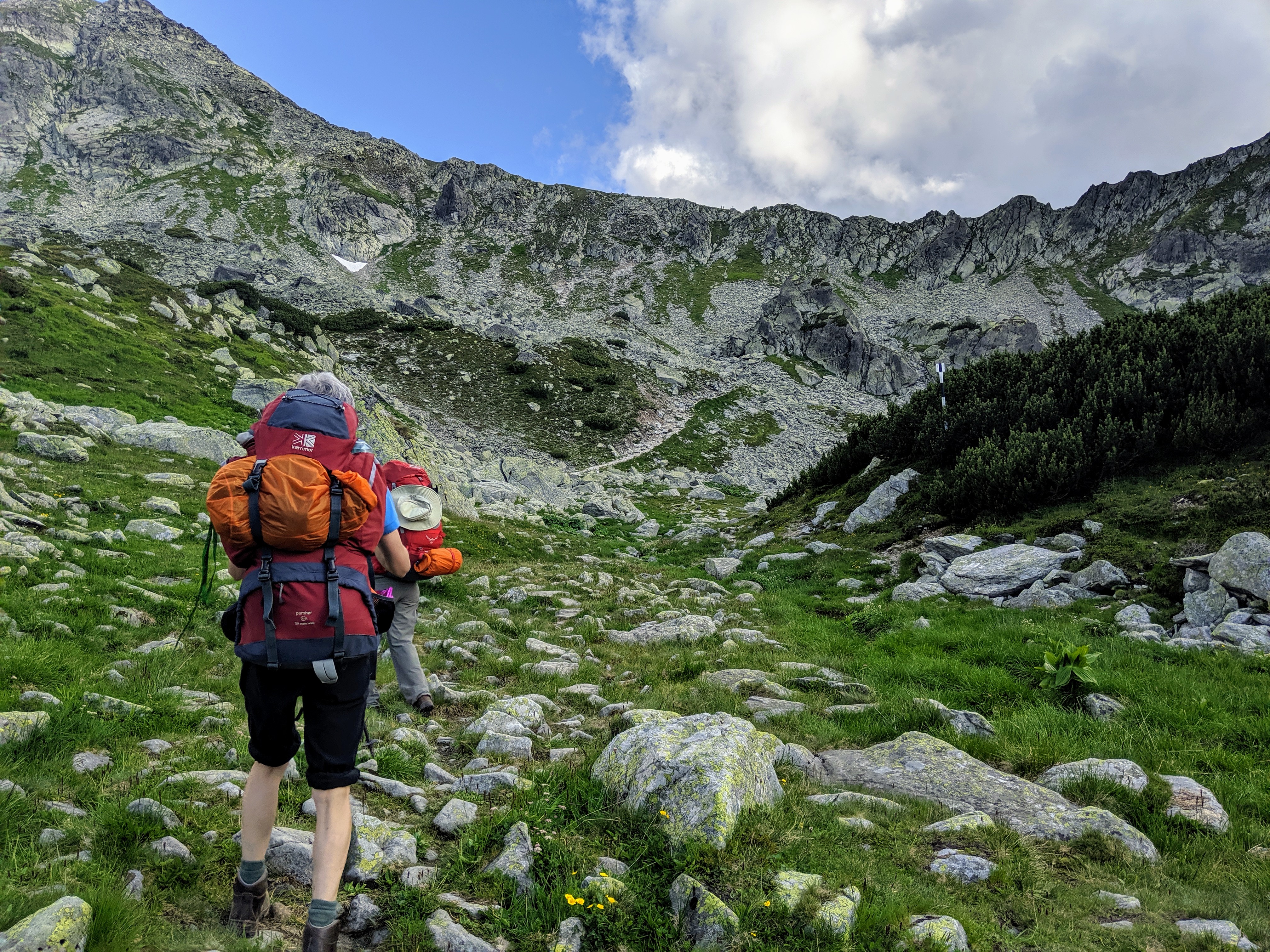
During the hike from Carnic to Bucura you are looking at 3500ft ascent, which took us 6 hours at a relaxed pace (probably quicker if you are not carrying 20kg of kit).
The route involves a steep walk along a gravel/mini boulder path; trails that follow and cross rivers; paths within wooded areas; and best of all is when the trees thin and the blue sky becomes visible along with the view of the stunning surrounding mountains.
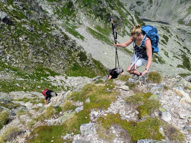
You also get the less pleasant opportunity to see the ridge that you need to climb over to get to Bucura. It is a fun scramble to the top of the ridge but does require a couple of tea and biscuit breaks to ensure you don’t burn out!
As you appear over the top of the ridge and see Bucura Lake on the far side, you do forget about the rock climbing session you have just experienced, and simply take in the stunning view thought. It’s all downhill from there.
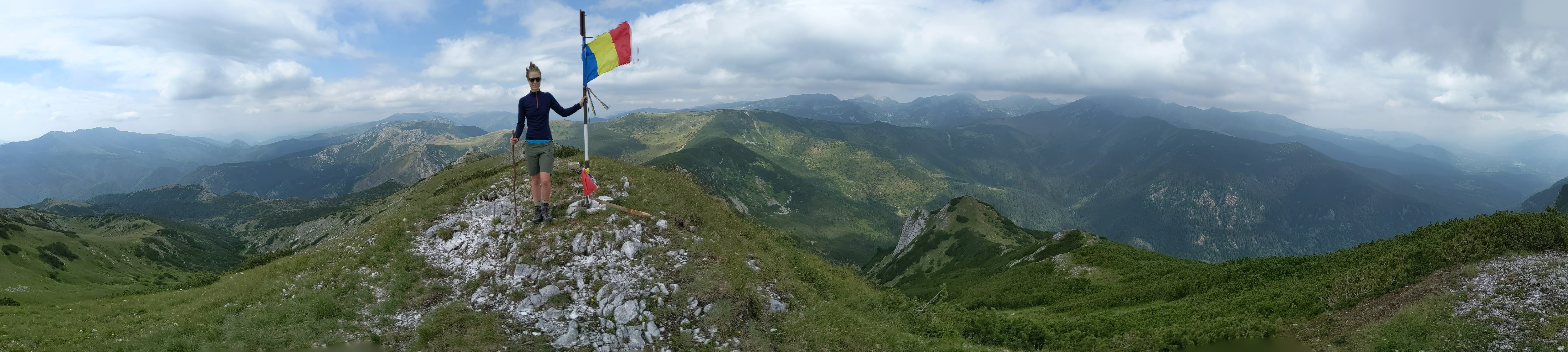
Vf. Peleaga and Vf. Papusa
Climbing Vf. Peleaga (2509m) and Vf. Papusa (2508m) is well worth the hike. To start the day we summited Peleaga in brilliant clear conditions and then continued onto Papusa, which was covered in cloud (but that’s mountains for you).
From Papusa we descended on a much less used path to Papusa Mica . My mother who suffers from being a typical mother (which means she worries a lot) was put through her paces on this part of the day as we descended and ascended along a number of narrow ridge lines that drop away sharply. I personally thought it was great fun, and what is a day of hiking if you are not scrambling along almost untouched paths.
We then had to make up our own path (following sporadically placed cairns) to get down into the foot of the valley. The beautiful river at the bottom made for a perfect late lunch spot where we could also dip our toes.
To continue back to our base at Bucura, we followed the river around towards the base of the Piscul Pelegii mountain range, towards Polana Pelegii. Once reaching Pelegii it was then a 1.5hr climb back up through the woods towards Bucura.
This is a very long day (around 9 hours with breaks), but if the conditions allow I’d highly recommend it!
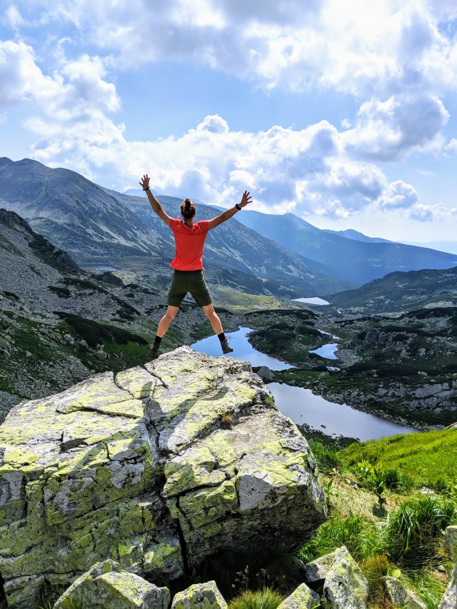
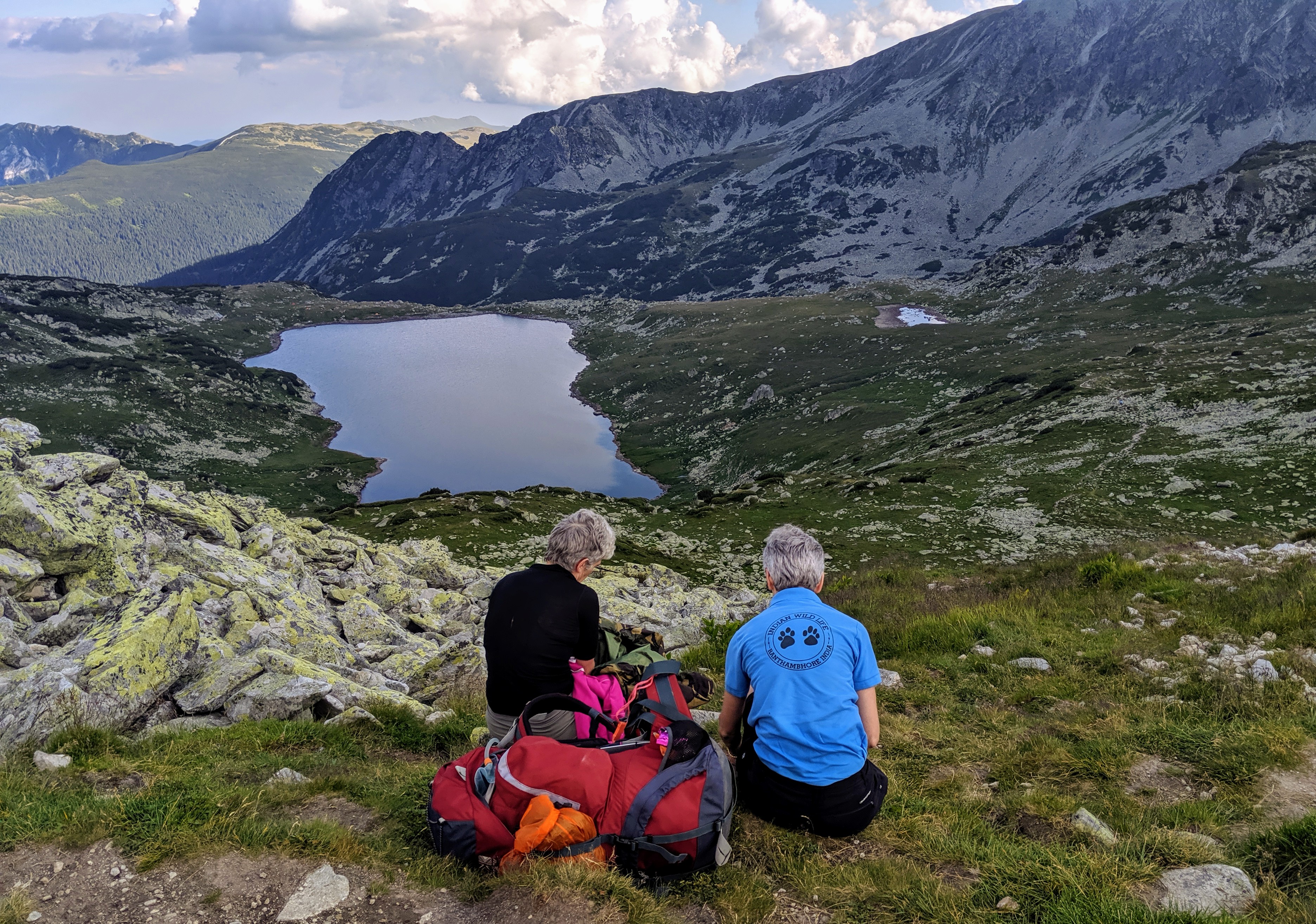
The Lake Loop
If you are looking for a more relaxing day, from Bucura there is a nice short loop that passes and/or provides epic views of a large number of lakes. We actually spent around 30 minutes at Tau Portii lake just sitting watching a family of Marmots.
Bucura to Buta
On the map, the hike from Bucura to Buta looks relatively straight forward; however, don’t let those contour lines deceive you.
The hike starts with a descent towards Peliegii at the bottom of the valley. From here it is back up, and the up gets very steep.
Getting to the top of this mountain is amazing though as you feel like you are in a completely different area, with open meadows and trees visible higher up the mountains. Enjoy the short lived spate of lush grass as to get to the camp you need to head down, what feels like a scree slope, to get to Buta. On the plus side you can see the campsite while descending, which lifts your hopes.
Vf. Piule
We had hoped to do a loop from Buta up Culmea Dragsanu, however the Mountain Rescue chaps advised us that the dwarf pine was far too overgrown on a section of the proposed loop and so would be highly unlikely to get past. Instead we resorted to a straight forward up and down of Vf. Piule. Again this hike involves some very steep slopes, where hiking sticks would be highly recommended (particularly for the way back down).
The climb up and along Vf Pieule from the Saua Scorota saddle is very exposed to the elements and probably impassable when it is too windy, but we got lucky and managed to get to the top with no issues (apart from my mother overthinking the very steep slope under her boots).
Once again, the views from here are breath taking and show you a different valley (limestone as opposed to granite I believe).
A note on bears…
There are brown bears in Romania! (Un)fortunately we did not have the privilege of seeing any of the 6000 that are estimated to roam the Carpathian Mountains. From the bits of research I did, plus talking with Park Rangers on arrival, we were advised that the bears tend to stay away from the hiking trails as they prefer their privacy. However, this is not to say that you won’t come across a bear in the wild, so the top tip we were given is to always make some form of noise, either by talking, singing or carrying a simple bear bell.
Before arriving at the Park I had concerns regarding storing our food and rubbish. We were in the Park for 7 days and consequently needed to carry plenty of food (and consequential rubbish). I extensively researched bear proof food storage solutions, but found these to be really expensive or inconvenient when our bags were already going to be heavy and full. I couldn’t see any serious concerns on the few Retezat National Park blogs so in the end we simply bought some Paracord so that we could hang the food from trees in our dry bags if the need arose.
It turns out that the main wildlife concern in the designated camp areas are savvy foxes and sneaky farm dogs.
With advice from the mountain rescue teams dotted around the National Park we simply ensured that all food and packaging was kept inside our tents and kept it all well sealed where possible. Due to the amount of food we took we were using Ration Packs for our meals, which are very well sealed packages. And then for our rubbish we bagged this all together and stored in large zip lock bags.